ViewTube

ViewTube
Sign inSign upSubscriptions
Filters

Upload date

Type

Duration

Sort by

Features

Reset

13 results

Geojay GIS Solution
Land Use Land Cover Classification in GEE

... Data, MODIS, Sentinel Data, Landsat, Image Processing, Classification Algorithms, Pixel Classification, Object-Based Analysis, ...

0:32
Land Use Land Cover Classification in GEE

0 views

21 hours ago

艾森 Essen
Python strangles and suffocates Taiwan: Deciphering the logic behind the "Justice Mission" milita...

Why did a seemingly insignificant black-and-white photograph signal the complete collapse of Taiwan's air defense system? When ...

33:18
Python strangles and suffocates Taiwan: Deciphering the logic behind the "Justice Mission" milita...

46,596 views

20 hours ago

SHAOS TV
Sonny Shaos Explores Computer History - Ep.1 "1977" (TRS-80)

1st episode of experimental AI generated show "Sonny Shaos Explores Computer History" is talking about 1977 when TRS-80 ...

8:05
Sonny Shaos Explores Computer History - Ep.1 "1977" (TRS-80)

28 views

11 hours ago

Mahdi Shahbazi Khojasteh
🏡 (House Price Prediction) قسمت ۹۰: تخمین قیمت خانه‌ها (مسئله رگرسیون) - بارگذاری دیتاست

... پردازش تصویر دیجیتال (Digital Image Processing) شبکه‌های کانولوشنال (CNNs) و ساختار آن‌ها مدل‌های مهم مانند LeNet, AlexNet, ...

6:03
🏡 (House Price Prediction) قسمت ۹۰: تخمین قیمت خانه‌ها (مسئله رگرسیون) - بارگذاری دیتاست

0 views

9 hours ago

Learn-With-Nikk
Turning Images into High-Accuracy ASCII Art with Python

In this video, we dive into a classic programming challenge: turning digital images into high-accuracy ASCII art! We'll walk through ...

8:19
Turning Images into High-Accuracy ASCII Art with Python

0 views

5 hours ago

CodeWithVansh
Smart Crop Health Monitoring Using Low-Cost Multispectral Imaging | e-Yantra IIT Bombay

This video demonstrates our project: Low-Cost Multispectral Imaging for Smart Crop Health Monitoring, developed by Team ...

4:08
Smart Crop Health Monitoring Using Low-Cost Multispectral Imaging | e-Yantra IIT Bombay

11 views

7 hours ago

Craig Parker
What is Geospatial Data Science?: From Data to Action

... presentation generation • pdf2image - PDF to high-resolution slide extraction • Pillow (PIL) - Image processing and optimization ...

2:59
What is Geospatial Data Science?: From Data to Action

2 views

11 hours ago

Craig Parker
What is Geospatial Data Science?: From Data to Action

... presentation generation • pdf2image - PDF to high-resolution slide extraction • Pillow (PIL) - Image processing and optimization ...

2:59
What is Geospatial Data Science?: From Data to Action

0 views

11 hours ago

Unknown27s
Antigravity Built for ollama Chat box

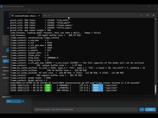
Inspiration The inspiration for **Antigravity Chat** came from a desire to reclaim privacy in the age of AI. While cloud-based LLMs ...

0:40
Antigravity Built for ollama Chat box

8 views

20 hours ago

Craig Parker
Johannesburg's Heat Vulnerability: A Legacy of Inequality

... presentation generation • pdf2image - PDF to high-resolution slide extraction • Pillow (PIL) - Image processing and optimization ...

7:46
Johannesburg's Heat Vulnerability: A Legacy of Inequality

3 views

10 hours ago

ADHD Brain
2026 Python & AI Career Guide: Full Roadmap, Projects & Resources

Welcome to your comprehensive guide to navigating the 2026 Python and AI landscape. Whether you are a total beginner or ...

6:10
2026 Python & AI Career Guide: Full Roadmap, Projects & Resources

10 views

23 hours ago

Vallzen
Deteksi & Hitung Objek Otomatis dengan OpenCV | Demo Proyek Streamlit

Demo Aplikasi: Penghitungan Objek Kecil Berbasis Image Processing & Streamlit Halo semuanya! Video ini merupakan ...

6:42
Deteksi & Hitung Objek Otomatis dengan OpenCV | Demo Proyek Streamlit

5 views

17 hours ago