ViewTube

ViewTube
Sign inSign upSubscriptions
Filters

Upload date

Type

Duration

Sort by

Features

Reset

151 results

GIS Developer
Python Geospatial Visualization EXPLAINED | GeoPandas, Matplotlib & Plotly

In this tutorial, we explore how to visualize geospatial data in Python without using Folium โ€” a common challenge for GISย ...

27:16
Python Geospatial Visualization EXPLAINED | GeoPandas, Matplotlib & Plotly

54 views

1 month ago

DigitalSreeni
3D Organoid Data Analysis with Python | Tutorial 1: Introduction & Pipeline Overview

Learn how to analyze 3D organoid imaging data using Python and machine learning with real published datasets from Natureย ...

36:28
3D Organoid Data Analysis with Python | Tutorial 1: Introduction & Pipeline Overview

1,294 views

2 weeks ago

Geomatica Ambiental
๐Ÿš€๐ŸŒŽ Course Summary: Geographic Information Systems with Python๐Ÿ๐Ÿ—บ๏ธ

Do you want to become a GIS expert with Python and automate professional geospatial processes? This course will take you from ...

6:42
๐Ÿš€๐ŸŒŽ Course Summary: Geographic Information Systems with Python๐Ÿ๐Ÿ—บ๏ธ

35 views

9 days ago

GIScience
Beginner Python in ArcGIS Pro Notebooks: Geospatial Data Analysis Skills  #Python #ArcGISPro #GIS

Learn Python for geospatial data analysis using ArcGIS Pro Notebooks (built on Jupyter notebooks)โ€”a practical, job-relevantย ...

1:09:10
Beginner Python in ArcGIS Pro Notebooks: Geospatial Data Analysis Skills #Python #ArcGISPro #GIS

255 views

3 weeks ago

Matt Forrest
Mastering Spatial Data in R: TidyCensus, PMTiles, & AI with Kyle Walker

... Data is Critical Infrastructure 00:09:20 โ€“ Demystifying Census Data with tigris and tidycensus 00:15:48 โ€“ Applied Spatial Data:ย ...

50:31
Mastering Spatial Data in R: TidyCensus, PMTiles, & AI with Kyle Walker

1,584 views

2 weeks ago

Data Science with Onur
Data Visualization with Python Course [2026] - Part 3: Categorical, Statistical & Geospatial Charts

In Part 3 of this Data Visualization with Python Course 2026, you will create categorical, advanced statistical, and geospatialย ...

16:25
Data Visualization with Python Course [2026] - Part 3: Categorical, Statistical & Geospatial Charts

84 views

2 weeks ago

Matt Forrest
Stop Using Files for GIS. Build This Instead.

... Cloud-Optimized GeoTIFF, PMTiles) reduce cost and increase flexibility - What a spatial data catalog does (Apache Iceberg,ย ...

12:45
Stop Using Files for GIS. Build This Instead.

2,458 views

5 days ago

Zbigniew Mikulski
Exporting Data for Clustering, Python, and Spatial Modeling

Take your research to the next level by bridging QuPath with the global ecosystem of bio-image analysis. In this final session ofย ...

45:24
Exporting Data for Clustering, Python, and Spatial Modeling

88 views

1 month ago

Matt Forrest
The Death of the "GIS Analyst" (7 New Roles Replacing It)

The difference between a Geospatial Data Engineer and an Analytics Engineer. - How Spatial Data Scientists differ fromย ...

14:24
The Death of the "GIS Analyst" (7 New Roles Replacing It)

3,631 views

3 weeks ago

Milan's Data Stories
Geospatial Data Science Essentials e-Book - Second Edition

Geospatial Data Science Essentials is a hands-on guide to geospatial analytics with Python. It distills 101 core concepts โ€” fromย ...

6:43
Geospatial Data Science Essentials e-Book - Second Edition

424 views

3 weeks ago

Matt Forrest
Stop Learning New GIS Tools. (Master These 4 Instead)

Forget trying to learn every single tool in the modern GIS stack. It's a trap. The geospatial industry is exploding with new software,ย ...

12:18
Stop Learning New GIS Tools. (Master These 4 Instead)

3,145 views

3 weeks ago

Milan's Data Stories
Geospatial Data Science Essentials - AI discussion

Milan Janosov's book provides a Python-based guide to geospatial data science. It covers vector and raster processing usingย ...

16:53
Geospatial Data Science Essentials - AI discussion

114 views

7 days ago

casaGeo
Streamline Geo Data Science: HERE Connector for Python

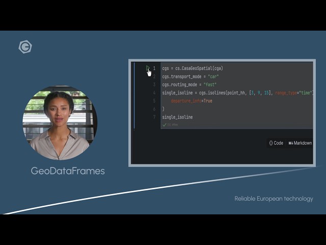
Get your Geo Data Science projects moving faster with the HERE Connector for Python by casaGeoTools. In this video, we showย ...

1:09
Streamline Geo Data Science: HERE Connector for Python

9 views

7 days ago

School of Programming and Software Development
Exploratory Data Analysis  - Python (Week 7 - Lesson 1)

School of Programming and Software Development sop-AI-101: Python for Data Science This lesson introduces us to Exploratoryย ...

5:15
Exploratory Data Analysis - Python (Week 7 - Lesson 1)

18 views

13 days ago

Terra Spatial
Calculate Monthly Total Suspended Matter (TSM) Using Sentinel-2A Image | GEE Python Colab

In this complete scientific workflow, you'll learn how to calculate Monthly Total Suspended Matter (TSM) using Google Earthย ...

49:29
Calculate Monthly Total Suspended Matter (TSM) Using Sentinel-2A Image | GEE Python Colab

368 views

9 days ago

Geomatica Ambiental
๐Ÿšจ๐ŸŽ“ ๐‘๐ž๐ฌ๐ฎ๐ฆ๐ž๐ง ๐‚๐ฎ๐ซ๐ฌ๐จ: ๐…๐จ๐ญ๐จ๐ ๐ซ๐š๐ฆ๐ž๐ญ๐ซ๐ขฬ๐š ๐š๐ฏ๐š๐ง๐ณ๐š๐๐š ๐œ๐จ๐ง ๐ƒ๐‰๐ˆ ๐“๐ž๐ซ๐ซ๐š, ๐๐ข๐ฑ๐Ÿ’๐ƒ, ๐Œ๐ž๐ญ๐š๐’๐ก๐š๐ฉ๐ž, ๐๐ฒ๐ญ๐ก๐จ๐ง, ๐†๐„๐„ ๐ฒ ๐€๐ซ๐œ๐†๐ˆ๐’ ๐๐ซ๐จ

This program will take you from beginner to professional level in drone photogrammetric processing. You will learn: โœˆ๏ธ To ...

1:50
๐Ÿšจ๐ŸŽ“ ๐‘๐ž๐ฌ๐ฎ๐ฆ๐ž๐ง ๐‚๐ฎ๐ซ๐ฌ๐จ: ๐…๐จ๐ญ๐จ๐ ๐ซ๐š๐ฆ๐ž๐ญ๐ซ๐ขฬ๐š ๐š๐ฏ๐š๐ง๐ณ๐š๐๐š ๐œ๐จ๐ง ๐ƒ๐‰๐ˆ ๐“๐ž๐ซ๐ซ๐š, ๐๐ข๐ฑ๐Ÿ’๐ƒ, ๐Œ๐ž๐ญ๐š๐’๐ก๐š๐ฉ๐ž, ๐๐ฒ๐ญ๐ก๐จ๐ง, ๐†๐„๐„ ๐ฒ ๐€๐ซ๐œ๐†๐ˆ๐’ ๐๐ซ๐จ

23 views

10 days ago

Geomatica Ambiental
๐Ÿ“Š๐Ÿ Course Summary: Geography applied with Python

Turn spatial data into professional decisions with predictive analytics Geospatial data science is one of the most in-demand ...

5:45
๐Ÿ“Š๐Ÿ Course Summary: Geography applied with Python

90 views

10 days ago

DigitalSreeni
3D Organoid Analysis - Tutorial 2 - Data Exploration

3D Organoid Data Exploration: Understanding Structure, Quality & Relationships in Python Before analyzing organoid data, youย ...

41:43
3D Organoid Analysis - Tutorial 2 - Data Exploration

393 views

5 days ago

Final Draft Mapping
Adding Point Features to an ArcGIS Online Feature Layer with the ArcGIS API for Python

Full Course https://www.youtube.com/playlist?list=PLWlgkWEhTvz0oqrq6PP6ZbkMqCLXXMNsT Learn how to *add pointย ...

4:20
Adding Point Features to an ArcGIS Online Feature Layer with the ArcGIS API for Python

32 views

12 days ago

Native GIS
Spatial AI Scientist: Skills & Career Path Revealed

Spatial AI Scientist is redefining how artificial intelligence works with geography, spatial data, and real-world systems. In this videoย ...

4:50
Spatial AI Scientist: Skills & Career Path Revealed

135 views

2 weeks ago