ViewTube

ViewTube
Sign inSign upSubscriptions
Filters

Upload date

Type

Duration

Sort by

Features

Reset

11,046 results

Dutton Institute
GEOG 884, Spatial Data Science and Intelligence Analysis

Geospatial Education at Penn State. For more information go to www.pennstategis.com or https://gis.e-education.psu.edu/

1:41
GEOG 884, Spatial Data Science and Intelligence Analysis

241 views

3 years ago

Dutton Institute
GEOG 858, Spatial Data Science for Emergency Management

Geospatial Education at Penn State. For more information go to www.pennstategis.com or https://gis.e-education.psu.edu/

1:22
GEOG 858, Spatial Data Science for Emergency Management

200 views

3 years ago

Dutton Institute
Geography 581, Spatial Data Science Ethics

Geospatial Education at Penn State. For more information go to www.pennstategis.com or https://gis.e-education.psu.edu/

2:41
Geography 581, Spatial Data Science Ethics

292 views

3 years ago

Daniel Arribas-Bel
New forms of (geo) data - A Course on Geographic Data Science

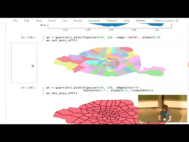
Block C of the Geographic Data Science course - "Spatial Data" More materials related to the content in this video are available at: ...

28:36
New forms of (geo) data - A Course on Geographic Data Science

425 views

4 years ago

Daniel Arribas-Bel
Exploratory Spatial Data Analysis (ESDA) - A Course on Geographic Data Science

Block F of the Geographic Data Science course - "ESDA" More materials related to the content in this video are available at: ...

4:27
Exploratory Spatial Data Analysis (ESDA) - A Course on Geographic Data Science

1,346 views

4 years ago

R Consortium
Analyzing Geospatial Data in R (Sherrie Xie)

Sherrie Xie, Post-doctoral research fellow at the University of Pennsylvania gave a workshop at the R/Medicine 2022 Virtual ...

2:01:43
Analyzing Geospatial Data in R (Sherrie Xie)

13,393 views

3 years ago

Northeast Big Data Innovation Hub
Geospatial Analysis Flashcard #1: What is Geospatial Data?

Learn about Geospatial Analysis with the National Student Data Corps! What is geospatial data and why is it so important?

2:57
Geospatial Analysis Flashcard #1: What is Geospatial Data?

905 views

1 year ago

Hydro-Morphodynamics
Basic Geospatial Data Types

Get to know geospatial data types (basics) in the form of vector and raster data based on explanations from ...

15:17
Basic Geospatial Data Types

319 views

3 years ago

Daniel Arribas-Bel
Infusing our understanding of Cities with Geographic Data Science - Dani Arribas-Bel

"Infusing our understanding of Cities with Geographic Data Science" Talk given by Dani Arribas-Bel as a virtual colloquium at the ...

43:51
Infusing our understanding of Cities with Geographic Data Science - Dani Arribas-Bel

508 views

4 years ago

Dutton Institute
GEOG 479 At Penn State:  Spatial Data Science for Cyber and Human Social Networks

Geospatial Education at Penn State. For more information go to www.pennstategis.com or https://gis.e-education.psu.edu/

2:09
GEOG 479 At Penn State: Spatial Data Science for Cyber and Human Social Networks

346 views

3 years ago

Software Underground
Tutorial: Geospatial Analysis in Python

TRANSFORM 2020 - Virtual Conference Speaker: Martin Bentley To access the repos link: https://swu.ng/t20-fri-geo Dedicated ...

3:18:45
Tutorial: Geospatial Analysis in Python

3,691 views

Streamed 5 years ago

Dutton Institute
GEOG 487 Environmental Challenges in Spatial Data Science

Geospatial Education at Penn State. For more information go to www.pennstategis.com or https://gis.e-education.psu.edu/

1:43
GEOG 487 Environmental Challenges in Spatial Data Science

79 views

2 years ago

FOSS4G
FOSS4G 2022 | Geospatial data science for planning education systems

The presentation will share how UNESCO's International Institute for Educational Planning (IIEP) applies FOSS4G technologies to ...

16:44
FOSS4G 2022 | Geospatial data science for planning education systems

9 views

1 year ago

Data Science Learning Community Videos
Fundamentals of Data Viz: Visualizing trends & Visualizing geospatial data (dataviz01 14 15)

Josh Persi leads a discussion of Chapter 14 ("Visualizing trends") and Chapter 15 ("Visualizing geospatial data") from ...

50:01
Fundamentals of Data Viz: Visualizing trends & Visualizing geospatial data (dataviz01 14 15)

86 views

4 months ago

IEEE GRSS
Data Science and Geospatial Model Tuning | HDCRS Summer School 2023 | Day 2

Day 2 of the Summer School 2023 on May 30 featured a hands-on session exploring scalable data science, orchestrated by IBM ...

58:16
Data Science and Geospatial Model Tuning | HDCRS Summer School 2023 | Day 2

359 views

2 years ago

EuroSciPy
EuroSciPy 2017: GeoPandas - geospatial data in Python made easy

Presenter: Joris Van den Bossche.

28:17
EuroSciPy 2017: GeoPandas - geospatial data in Python made easy

12,402 views

8 years ago

Data Science Learning Community Videos
Spatial Data Science: Proximity and Areal Data (spatial01 14)

Derek Sollberger leads a discussion of Chapter 14 ("Proximity and Areal Data") from Spatial Data Science with applications in R ...

55:28
Spatial Data Science: Proximity and Areal Data (spatial01 14)

82 views

2 years ago

FOSS4G:UK
Shaping Open Spatial Data Science by Anita Graser

... about shaping open spatial data science so just a brief introduction Anita is a researcher open source developer and author she ...

36:10
Shaping Open Spatial Data Science by Anita Graser

403 views

Streamed 3 years ago

Spatial Data Science Symposium
SDSS 2023: Session 2: Spatial Data Science for Disaster Resilience

Recorded during the Spatial Data Science Symposium (SDSS 2023), September 5-6, 2023, distributed & online Session 2: ...

48:12
SDSS 2023: Session 2: Spatial Data Science for Disaster Resilience

249 views

2 years ago

Center of Expertise in Big Geodata Science
3.3 CGC: an open-source Python module for geospatial data clustering

Dr. Francesco Nattino (eScience Center) introduces the Clustering Geo-Data Cubes (CGC) package, which focuses on the needs ...

10:55
3.3 CGC: an open-source Python module for geospatial data clustering

298 views

3 years ago

Introduction to Data Science
Spatial Data Analysis 1: Introduction

An introduction to spatial data analysis for data scientists.

3:09
Spatial Data Analysis 1: Introduction

622 views

3 years ago

FOSS4G
FOSS4G 2021 - Using Jupyter Notebooks for viewing and analyzing geospatial data: Two examples for...

Using Jupyter Notebooks for viewing and analyzing geospatial data: Two examples for emotional maps and educational data This ...

27:42
FOSS4G 2021 - Using Jupyter Notebooks for viewing and analyzing geospatial data: Two examples for...

638 views

4 years ago

Data Science Learning Community Videos
Geospatial health: Spatial data and R packages for mapping (geohealth01 2)

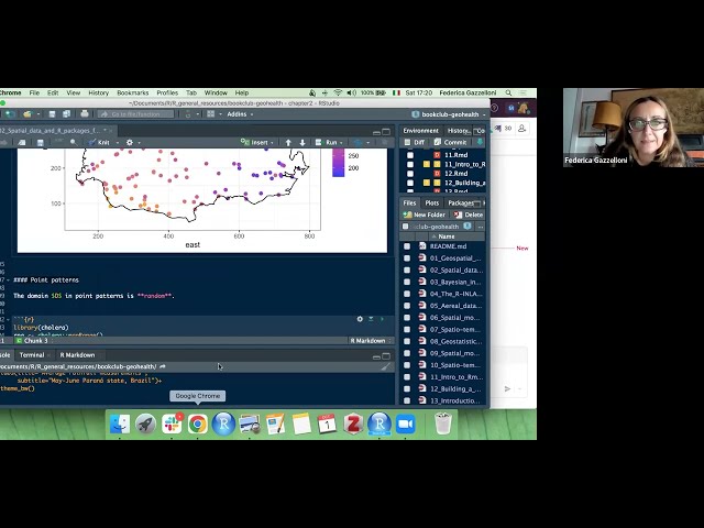
Federica Gazzelloni presents Chapter 2 ("Spatial data and R packages for mapping") from Geospatial Health Data: Modeling and ...

1:03:08
Geospatial health: Spatial data and R packages for mapping (geohealth01 2)

286 views

3 years ago

Northeast Big Data Innovation Hub
Geospatial Analysis Flashcard #4: What is Geospatial Data Processing?

Learn about Geospatial Analysis with the National Student Data Corps! Why is geospatial data processing important? What are ...

2:12
Geospatial Analysis Flashcard #4: What is Geospatial Data Processing?

399 views

1 year ago

FOSDEM
Open source Big Geospatial Data analytics

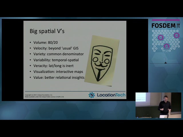
by Marc Vloemans At: FOSDEM 2018 Room: AW1.126 Scheduled start: 2018-02-04 12:00:00+01.

23:25
Open source Big Geospatial Data analytics

257 views

7 years ago