Upload date
All time
Last hour
Today
This week
This month
This year
Type
All
Video
Channel
Playlist
Movie
Duration
Short (< 4 minutes)
Medium (4-20 minutes)
Long (> 20 minutes)
Sort by
Relevance
Rating
View count
Features
HD
Subtitles/CC
Creative Commons
3D
Live
4K
360°
VR180
HDR
380 results
Pebesma, Edzer R Spatial is a lively community of people using R for analysing spatial data. From the early days of R, spatial ...
2,065 views
4 years ago
This video is part of the virtual useR! 2020 conference. Find supplementary material on our website https://user2020.r-project.org/ ...
1,361 views
5 years ago
Geospatial Education at Penn State. For more information go to www.pennstategis.com or https://gis.e-education.psu.edu/
1,484 views
7 years ago
... geopandas dot spatial join and then i can pass in two data frames data frame one and data frame too so this is a spatial join and ...
575 views
This is an audio version of the Wikipedia Article: https://en.wikipedia.org/wiki/Spatial_analysis 00:01:22 1 History 00:03:12 2 ...
45 views
6 years ago
Jess Hoffelder and Ganhua Lu, University of Wisconsin Madison Population Health Institute Access to exercise opportunities is a ...
76 views
2 years ago
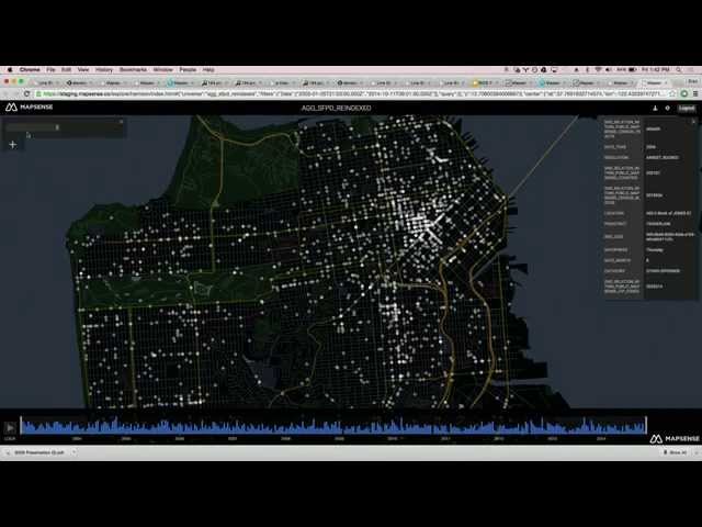
NYC School of Data 2024 - March 23, 2024 28 Spatial Analysis of NYC Open Data using ArcGIS Jim Barry - Solution Engineer, ...
267 views
This video is an introduction to vector data and how to work with it in R. Vector data includes all kinds of spatial data that are not ...
6,747 views
in this video, I am teaching the basics of [geospatial and graphical] computing in Python and go through an exercise in Python ...
86 views
1 year ago
BIDS Data Science Lecture Series | February 13, 2015 | 1:00-2:30 p.m. | 190 Doe Library, UC Berkeley Speaker: Erez Cohen, ...
13,388 views
Streamed 11 years ago
Week 11: Tutorial 10: Processing Satellite Precipitation Data Using Python.
1,879 views
This video is about how to save spatial data that we've created in R and write it out to the kinds of files that we've been loading in.
2,521 views
The development of this video is funded by the Department of Labor (DOL) Trade Adjustment Assistance Community College and ...
921 views
11 years ago
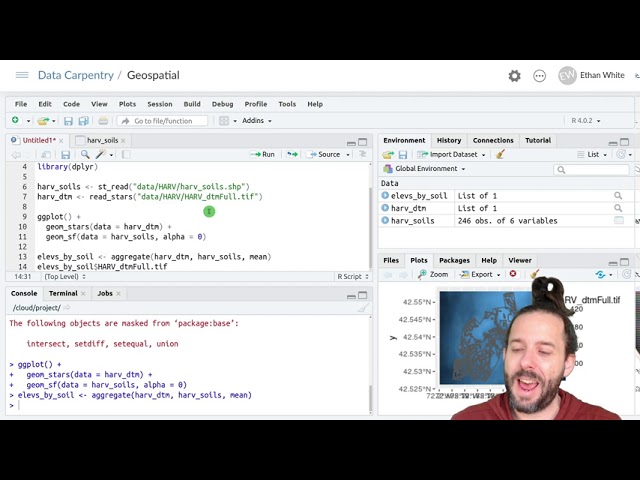
Data: https://datacarpentry.org/semester-biology/data/neon-geospatial-data.zip Full lessons (including multiple videos and ...
27,166 views
Data: https://datacarpentry.org/semester-biology/data/neon-geospatial-data.zip Written notes: ...
5,025 views
Week 8: Tutorial 07 Part 02: Altimetry Data In Python.
1,072 views
541 views
1,674 views
8 years ago
And if we run that line we'll see that we get out the seven elevations one matched to each row in the 'plots_harv_utm' spatial data ...
12,168 views
This video is part of MANTRA, the Research Data Management free online course created by the University of Edinburgh Data ...
5,323 views
12 years ago