Upload date
All time
Last hour
Today
This week
This month
This year
Type
All
Video
Channel
Playlist
Movie
Duration
Short (< 4 minutes)
Medium (4-20 minutes)
Long (> 20 minutes)
Sort by
Relevance
Rating
View count
Features
HD
Subtitles/CC
Creative Commons
3D
Live
4K
360°
VR180
HDR
119 results
Geospatial Education at Penn State. For more information go to www.pennstategis.com or https://gis.e-education.psu.edu/
1,413 views
7 years ago
This video Introduces the Jefferson Community and Technical College, GIS Data Analysis class (CIT 225). In this video Professor ...
188 views
8 years ago
... One of the common tasks that we want to perform in geospatial analysis is extracting data from rasters for use in our analyses.
11,968 views
5 years ago
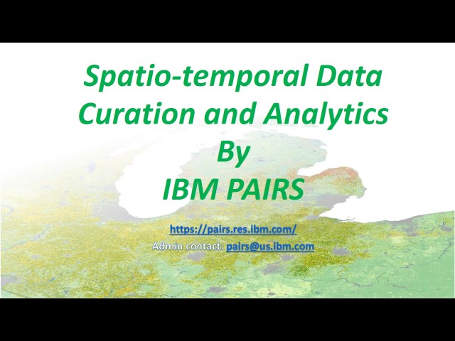
PAIRS (Physical Analytics Integrated Data and Repository Services) is a unique big-data spatio-temporal analytics service that is ...
1,907 views
9 years ago
NYC Open Data Week 2023 - Mar 14 2023 Curious about open data but not sure how to get started? Join Hunter College's ...
267 views
2 years ago
... modeling 00:28:43 3.8 Multiple-point geostatistics (MPS) 00:30:32 4 Geospatial analysis 00:33:52 4.1 Geographical information ...
45 views
6 years ago
During this course, you will complete a simple geospatial analysis using GEOINT's tools and tradecraft. You will experience real ...
1,277 views
11 years ago
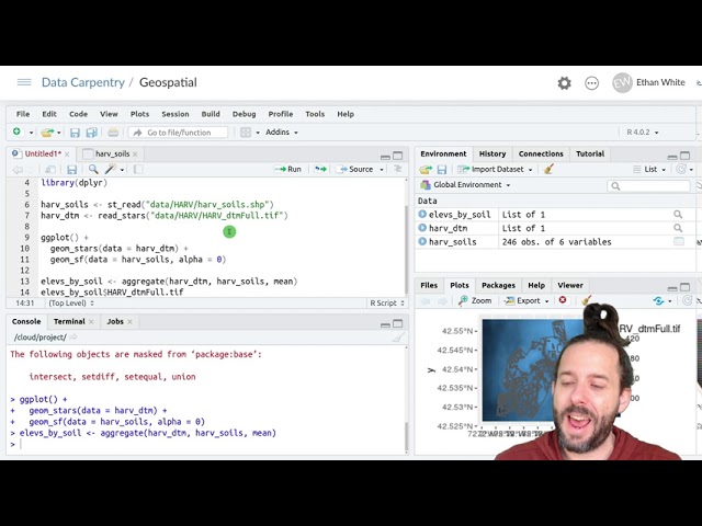
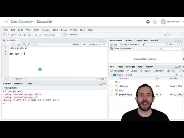
Data: https://datacarpentry.org/semester-biology/data/neon-geospatial-data.zip Full lessons (including multiple videos and ...
25,837 views
This video is a recording of the CESSDA Online Workshop "Using the Geographical Information System QGIS for data analysis", ...
514 views
3 years ago
Keywords ### #floodevents #morphometricanalysis #geospatialanalysis #JeddahCity #RedSeaCoast #SaudiArabia #RTCLTV ...
93 views
This video provides a brief introduction to PyGMT, an open-source Python library for geospatial processing, analysis, and ...
6,579 views
750 views
http://acolita.com I have some shapefiles, I tell #ChatGPT to create a map without using a #GIS program (#QGIS or #ArcGIS), and it ...
11,061 views
Recording of live video session for Lesson 2 of GEOG 485, SP19. This video was created for Penn State's GEOG 485: GIS ...
276 views
Get insights from Ed Parsons, Geospatial Technologist at google on: Why SDIs are not working like they are meant to be!
1,590 views
10 years ago
In this video lecture, you will be guided on how you can use the protocol (the Jupyter Notebook in Python protocol) to analyze ...
996 views
Data: https://datacarpentry.org/semester-biology/data/neon-geospatial-data.zip Written notes: ...
4,907 views
BIDS Data Science Lecture Series | February 13, 2015 | 1:00-2:30 p.m. | 190 Doe Library, UC Berkeley Speaker: Erez Cohen, ...
13,365 views
Streamed 11 years ago
This video is part of the virtual useR! 2020 conference. Find supplementary material on our website https://user2020.r-project.org/ ...
1,359 views
NYC Open Data Week 2024 98 Mapping open school and census data in New York City - March 19 2024 Matthew Curinga ...
43 views
1 year ago


![[WAPOROCW] M2-2.0 WAPORWP protocol Python](/api/proxy/image?url=https%3A%2F%2Fi.ytimg.com%2Fvi%2FsB66TKSdgGs%2Fsddefault.jpg)