Upload date
All time
Last hour
Today
This week
This month
This year
Type
All
Video
Channel
Playlist
Movie
Duration
Short (< 4 minutes)
Medium (4-20 minutes)
Long (> 20 minutes)
Sort by
Relevance
Rating
View count
Features
HD
Subtitles/CC
Creative Commons
3D
Live
4K
360°
VR180
HDR
91 results
Take your research to the next level by bridging QuPath with the global ecosystem of bio-image analysis. In this final session of ...
74 views
2 weeks ago
For more information on Nick Eagles, check https://bsky.app/profile/nick-eagles.bsky.social. For more information about the ...
28 views
5 months ago
In this comprehensive GIS tutorial, we'll move beyond basic mapping to answer a critical urban planning question: How ...
2,630 views
8 months ago
41 views
Reporting on spatial data shouldn't require you to ""bake the same cake"" repeatedly. I spent years collecting and processing ...
43 views
1 month ago
Canadian Bioinformatics Workshop series: - Introductory Spatial 'Omics Analysis: Visium HD, Feb. 20-21, 2025 - Building your ...
281 views
11 months ago
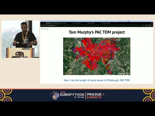
EuroPython 2025 — Terrace 2B on 2025-07-17] *Running every street in Paris with Python and PostGIS by Vinayak Mehta* ...
187 views
3 months ago
In this video, we will explore the powerful technique of kriging for interpolating station data using Python. Whether you're working ...
6 views
In this video, we'll explore the process of loading JSON data into a GeoDataFrame using Python. GeoDataFrames are essential ...
0 views
2 months ago
In this video, we will explore a powerful technique for matching data frames based on geographic proximity using Python.
1 view
In this video, we will explore how to calculate the distance between geographical coordinates represented by latitude and ...
7 views
In this video, we delve into the fascinating world of spatial data analysis using the S2/S2sphere library in Python. We'll explore ...
9 views
9 months ago
Overview of the rearchitected scraper classes. The workflow now leverages DuckDB, MinIO, and PostgreSQL using Python as a ...
32 views
With the introduction of the sf package, R became home to a first-class spatial data frame API. A growing number of R users, ...
858 views
7 months ago
By: Edzer Pebesma (IfGI) OpenGeoHub Summer School Wageningen 2025 ...
113 views
4 months ago
Using real world examples, this session will include an introduction to the Spatial Analyst and Image Analyst ArcPy modules, best ...
451 views
10 months ago
Whether you're a data scientist, a geographer, or just someone interested in visualizing spatial data, this tutorial will guide you ...
5 views
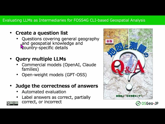
... knowledge and generate appropriate solutions for spatial analysis tasks. The complexity of CLI-based geospatial analysis tools ...
54 views
In this video, we delve into SciPy's powerful `distance_transform_edt` function, a crucial tool for image processing and analysis.
26 views
Presented by Alexander Kmoch on 19 November 2025 16:00, at FOSS4G 2025 Auckland. Track: Lightning talk Full presentation ...
25 views

![[2025-08-08] Intro to GeoPandas for spatial operations](/api/proxy/image?url=https%3A%2F%2Fi.ytimg.com%2Fvi%2FmXMcPmLUuu8%2Fsddefault.jpg)

![[2025-07-18] Plots in Python with seaborn and plotnine](/api/proxy/image?url=https%3A%2F%2Fi.ytimg.com%2Fvi%2FxK9UNcOfjnI%2Fsddefault.jpg)