Upload date
All time
Last hour
Today
This week
This month
This year
Type
All
Video
Channel
Playlist
Movie
Duration
Short (< 4 minutes)
Medium (4-20 minutes)
Long (> 20 minutes)
Sort by
Relevance
Rating
View count
Features
HD
Subtitles/CC
Creative Commons
3D
Live
4K
360°
VR180
HDR
80 results
... Data is Critical Infrastructure 00:09:20 – Demystifying Census Data with tigris and tidycensus 00:15:48 – Applied Spatial Data: ...
790 views
3 days ago
Master spatial data in Python! In this 60-second quickstart, Taisin shows you how to install casaGeoTools, set up secure ...
0 views
4 days ago
School of Programming and Software Development sop-AI-101: Python for Data Science This lesson introduces us to Exploratory ...
6 views
2 days ago
In Part 3 of this Data Visualization with Python Course 2026, you will create categorical, advanced statistical, and geospatial ...
54 views
IIRS-ISRO.
2,683 views
Streamed 3 days ago
Spatial AI Scientist is redefining how artificial intelligence works with geography, spatial data, and real-world systems. In this video ...
55 views
Full Course https://www.youtube.com/playlist?list=PLWlgkWEhTvz0oqrq6PP6ZbkMqCLXXMNsT Learn how to *add point ...
18 hours ago
“Calculate coverage area of point layer” → Quick spatial analysis without manual geoprocessing steps. 4. “Calculate average ...
10 hours ago
Spatial Analysis: "Calculate the total area of parks in this district" or "Find all bus stops within 500m of the metro station.
In this video, I showcase my latest computer vision project: Advanced Vision-Based ADAS with Real-Time Schematic Mapping.
84 views
Full Course https://www.youtube.com/playlist?list=PLWlgkWEhTvz0oqrq6PP6ZbkMqCLXXMNsT Learn how to *add polyline ...
3 views
... https://amazon.com/dp/B0FFW34LL3 Leanpub: https://leanpub.com/gispro Spatial Data Management with DuckDB: From ...
404 views
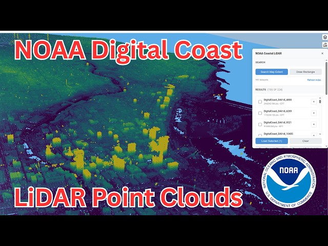
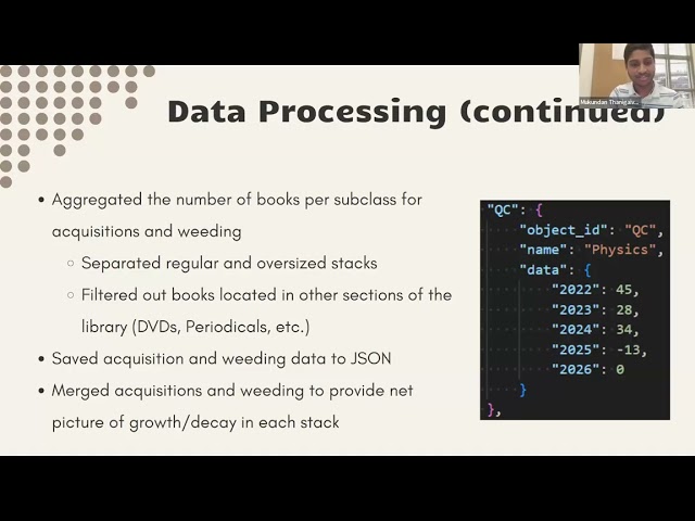
by Corinne Chatnik and Mukundan Thanigaivelan (Union College) As library collections evolve, understanding spatial growth ...
1 day ago
In this video, you'll learn the fastest and easiest method to create a powerful Wind Rose Diagram using Python in Google Colab, ...
282 views
I made an online file converter that converts anything to anything, and does so privately. Learn to code with Coddy: ...
468,426 views
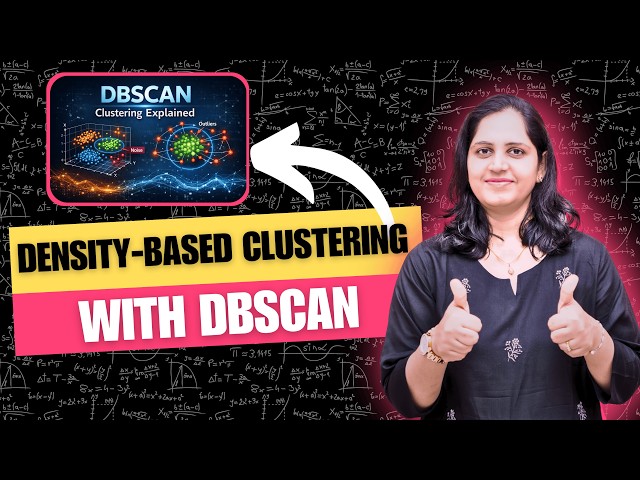
DBSCAN (Density-Based Spatial Clustering of Applications with Noise) is an unsupervised machine learning algorithm used to ...
489 views
6 days ago
3D Book → https://www.oreilly.com/library/view/3d-data-science/9781098161323/ 3D Knowledge → https://learngeodata.eu.
Designing a snake enclosure based on real habitat data changes everything. Deep in the ancient rocky ranges of Broken Hill, ...
508 views
5 days ago
Divyadrishti is a comprehensive dual-map web GIS platform, built using Flask, Leaflet, and GeoServer integration. The application ...
Large educational campuses often present challenges in navigation, information accessibility, and service coordination due to ...


![Data Visualization with Python Course [2026] - Part 3: Categorical, Statistical & Geospatial Charts](/api/proxy/image?url=https%3A%2F%2Fi.ytimg.com%2Fvi%2FR4mnsA5dctU%2Fsddefault.jpg)