ViewTube

ViewTube
Sign inSign upSubscriptions
Filters

Upload date

Type

Duration

Sort by

Features

Reset

494 results

SNU SFTL
Prediction of High-Resolution Dynamic Spatial Data Using U-Net and Diffusive-Time-of-Flight
6:10
Prediction of High-Resolution Dynamic Spatial Data Using U-Net and Diffusive-Time-of-Flight

0 views

6 days ago

Geojay GIS Solution
Analysis of Helsinki Land Cover Changes Using CORINE Land Cover Data for 2006, 2012 and 2018

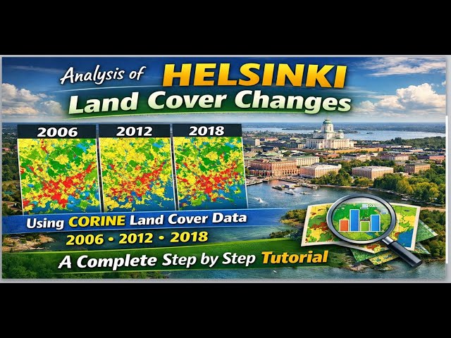
LandCoverAnalysis #CORINEData #HelsinkiGIS #finland #RemoteSensing #EnvironmentalChange In this detailed tutorial, we ...

28:55
Analysis of Helsinki Land Cover Changes Using CORINE Land Cover Data for 2006, 2012 and 2018

31 views

12 hours ago

PixelGEO
Built an AI Agent that thinks like a GIS Analyst | Agentic GeoAI | PixelGEO

What happens when you ask an AI to evaluate a neighbourhood? I built a GeoAI agent that reasons through spatial problems ...

6:32
Built an AI Agent that thinks like a GIS Analyst | Agentic GeoAI | PixelGEO

28 views

4 days ago

Cosmic Mysteries
BREAKING: 3I/ATLAS Anti-Tail Extension At 270M km — What This Reveals About Its True Nature

Recent imaging has detected a massive anti-tail extension on 3I/ATLAS, stretching an incredible 270 million kilometers.

41:20
BREAKING: 3I/ATLAS Anti-Tail Extension At 270M km — What This Reveals About Its True Nature

181 views

7 days ago

UCLA Office of Advanced Research Computing (OARC)
Spatial Research and the ESRI Ecosystem at UCLA

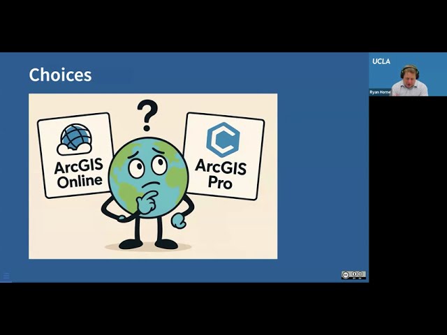
Monday, October 6, 2025, 10:00am-12:00pm, zoom Led by Ryan Horne ESRI is a leading industry provider of geospatial tools ...

1:06:00
Spatial Research and the ESRI Ecosystem at UCLA

43 views

6 days ago

Mehreen Fida
Hi, I’m Mehreen, a GIS Specialist skilled in digital mapping, spatial analysis, and remote sensing.

Hi, I'm Mehreen, a GIS Specialist skilled in digital mapping, spatial analysis, and remote sensing. I help clients turn geospatial ...

0:16
Hi, I’m Mehreen, a GIS Specialist skilled in digital mapping, spatial analysis, and remote sensing.

0 views

3 days ago

asif jahan
Welcome to My GIS & Remote Sensing Channel | Maps, Data & Real-World Solutions

gis #arcgistutorial #arcgisonline Welcome to my channel! I'm Asif Jahan, a GIS & Remote Sensing professional, helping ...

1:03
Welcome to My GIS & Remote Sensing Channel | Maps, Data & Real-World Solutions

0 views

7 days ago

Geospatial Solution
Quantum GIS Explained: High-Performance Spatial Computing with QGIS

Is your GIS software limiting how fast and how far you can analyze spatial data? In this video, we explore Quantum GIS (QGIS) ...

5:12
Quantum GIS Explained: High-Performance Spatial Computing with QGIS

97 views

7 days ago

Agricultural Tutorials
GIS Fundamentals 2026: Master Spatial Data Types in 10 Minutes

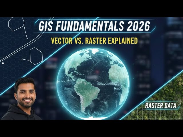
Master the Fundamentals of GIS and Spatial Data Types in this comprehensive 2026 guide. Whether you're a student, data ...

7:57
GIS Fundamentals 2026: Master Spatial Data Types in 10 Minutes

6 views

1 day ago

Berry Consultants
Statistical Communication

In this episode of “In the Interim…,” host Dr. Scott Berry examines the challenge of communicating complex statistical concepts to ...

41:31
Statistical Communication

110 views

7 days ago

Geojay GIS Solution
Water Quality Analysis In Arcgis tutorial

WaterQuality #ArcGIS #GISAnalysis #EnvironmentalScience #DataVisualization Buy me a coffee here: ...

0:21
Water Quality Analysis In Arcgis tutorial

0 views

1 day ago

SHARE3DCAM
This Is How LiDAR Data Actually Becomes CAD

Workflow overview: • On-site reality capture • Spatial data analysis and structural design • CAD integration with point cloud data ...

0:31
This Is How LiDAR Data Actually Becomes CAD

0 views

7 hours ago

Geojay GIS Solution
XY Coordinate Data Tutorial For ArcGIS Pro preview

ArcGISPro #XYCoordinates #GISData #MappingTutorial #SpatialAnalysis Buy me a coffee here: https://buymeacoffee.com/geojay ...

0:33
XY Coordinate Data Tutorial For ArcGIS Pro preview

0 views

1 day ago

GeoCortex AI and Consulting
Useful QGIS Plugins You Should Install

QGIS plugins can completely transform how you work with spatial data. In this video, I walk through essential QGIS plugins that ...

3:27
Useful QGIS Plugins You Should Install

31 views

6 days ago

Infer Sustainability
Spatial Code | Course Intro of Spatial code | GIS Courses for students

Discover the world of Spatial Code with our comprehensive Course Introduction! Designed for students interested in GIS and ...

1:45
Spatial Code | Course Intro of Spatial code | GIS Courses for students

4 views

5 days ago

Padang & Co
Cloudtim x M Moser - Real-Time Spatial Data Intelligence for Early Design Decisions
2:31
Cloudtim x M Moser - Real-Time Spatial Data Intelligence for Early Design Decisions

0 views

4 days ago

IN MY HUMBLE OPINION (IMHO Talk Show)
Crime Data Analyst Ckalib Nelson

crime #data #analytics #policing #communities #neighborhoods.

48:39
Crime Data Analyst Ckalib Nelson

8 views

7 days ago

Practical GIS
GeoSeries: In-depth breakdown

... on GeoPandas and other geospatial data analysis tools. Don't forget to hit the bell icon to get notified about the next episode!

5:09
GeoSeries: In-depth breakdown

0 views

4 days ago

Onidex Geo-Spatial Solutions
𝐀𝐢𝐫 𝐐𝐮𝐚𝐥𝐢𝐭𝐲 𝐌𝐨𝐧𝐢𝐭𝐨𝐫𝐢𝐧𝐠 𝐔𝐬𝐢𝐧𝐠 𝐑𝐞𝐦𝐨𝐭𝐞 𝐒𝐞𝐧𝐬𝐢𝐧𝐠 𝐚𝐧𝐝 𝐆𝐈𝐒 𝐓𝐞𝐜𝐡𝐧𝐢𝐪𝐮𝐞𝐬

Air Quality Monitoring Using Remote Sensing and GIS Techniques ...

6:47
𝐀𝐢𝐫 𝐐𝐮𝐚𝐥𝐢𝐭𝐲 𝐌𝐨𝐧𝐢𝐭𝐨𝐫𝐢𝐧𝐠 𝐔𝐬𝐢𝐧𝐠 𝐑𝐞𝐦𝐨𝐭𝐞 𝐒𝐞𝐧𝐬𝐢𝐧𝐠 𝐚𝐧𝐝 𝐆𝐈𝐒 𝐓𝐞𝐜𝐡𝐧𝐢𝐪𝐮𝐞𝐬

0 views

5 days ago

AEF SWIN
Meet One of Swinburne's Data Science Gurus

Join Dr Dan as he gets to know one of the departments leading data scientists, Dr Sarah Hegarty, and her astronomical research ...

10:54
Meet One of Swinburne's Data Science Gurus

4 views

7 days ago