ViewTube

ViewTube
Sign inSign upSubscriptions
Filters

Upload date

Type

Duration

Sort by

Features

Reset

150,897 results

Matt Forrest
Visualize geographic data in Python!

Ready to move beyond desktop GIS? Step into the Spatial Lab: a global community for ambitious geospatial professionals who ...

3:25
Visualize geographic data in Python!

13,118 views

1 year ago

Matt Forrest
Geospatial Python - Full Course for Beginners with Geopandas

Get the course files here: ...

2:04:52
Geospatial Python - Full Course for Beginners with Geopandas

68,283 views

1 year ago

UCLA Office of Advanced Research Computing (OARC)
Introduction to Spatial Statistics with Python

Workshop materials available here: https://github.com/yohman/workshop-python-spatial-stats Visual interpretations are ...

1:40:22
Introduction to Spatial Statistics with Python

17,270 views

4 years ago

GeoBootcamp
Full Course - Python for Geospatial Data Analysis for Beginners

Learn more: https://spatialelearning.com Get the full course: ...

1:00:22
Full Course - Python for Geospatial Data Analysis for Beginners

80,168 views

3 years ago

Andrea Ross
Introduction to Spatial Data Analysis with Python

by Jenny Palomino Attendees will learn about geoprocessing, analyzing and visualizing spatial data using Python and how it ...

37:06
Introduction to Spatial Data Analysis with Python

20,377 views

10 years ago

People also watched

Milos Makes Maps
Python: The Secret Weapon for Analyzing Google Earth Engine Data

In this video, we explore the powerful combination of Google Earth Engine and Python programming for advanced land cover ...

28:09
Python: The Secret Weapon for Analyzing Google Earth Engine Data

4,607 views

3 months ago

Matt Forrest
PostGIS, GeoPandas & DuckDB? Meet the One-Stop Spatial Engine

Meet SedonaDB, the newest open-source engine redefining spatial analytics. In this tutorial, I'll walk you through what SedonaDB ...

20:02
PostGIS, GeoPandas & DuckDB? Meet the One-Stop Spatial Engine

2,502 views

2 months ago

Enthought
Spatial Data Analysis with PySAL Tutorial | SciPy 2020 | Sergio Rey and Elijah Knaap

This tutorial is an introduction to geospatial data analysis in Python, with a focus on the Python Spatial Analysis Library (PySAL).

3:40:51
Spatial Data Analysis with PySAL Tutorial | SciPy 2020 | Sergio Rey and Elijah Knaap

12,657 views

5 years ago

GeoDev
Rasterio for absolutely beginner | Geospatial data analysis with python | GeoDev

Dataset: https://github.com/iamtekson/geospatial-data-analysis-python/raw/master/data/geotiff/nepal_lc_2020.tif Full course: ...

27:11
Rasterio for absolutely beginner | Geospatial data analysis with python | GeoDev

29,814 views

4 years ago

Software Underground
Tutorial: Geospatial Analysis in Python

TRANSFORM 2020 - Virtual Conference Speaker: Martin Bentley To access the repos link: https://swu.ng/t20-fri-geo Dedicated ...

3:18:45
Tutorial: Geospatial Analysis in Python

3,691 views

Streamed 5 years ago

BugBytes
Folium Mapping, Geopy Distance Calculations, and OpenStreetMap API Lookups in Python

Geospatial Python Playlist: https://www.youtube.com/playlist?list=PL-2EBeDYMIbRWlllfgcAJGkfUW0GFFrNu ☕ Buy a coffee: ...

11:52
Folium Mapping, Geopy Distance Calculations, and OpenStreetMap API Lookups in Python

43,697 views

4 years ago

The GIS Hub
GeoSpatial Analysis With Python For Beginners || Use Python For GIS Analysis || The GIS Hub

This "Geospatial Analysis With Python" is a beginner's course for those who want to learn the use of python for gis and geospatial ...

1:09:34
GeoSpatial Analysis With Python For Beginners || Use Python For GIS Analysis || The GIS Hub

41,757 views

3 years ago

The Life Code
Geospatial Analysis with Python

Learn how to use of Python for gis and geospatial analysis. This course will cover the basics of geopandas for beginners for ...

1:09:35
Geospatial Analysis with Python

476 views

2 years ago

Kenneth Steif
Geospatial Machine Learning: Predicting fire risk in San Francisco

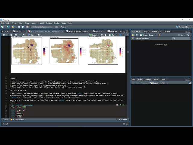
Learn how to estimate a geospatial risk predictive model in R. Using open data from San Francisco, we learn new tools for helping ...

51:44
Geospatial Machine Learning: Predicting fire risk in San Francisco

4,985 views

4 years ago

UCLA Office of Advanced Research Computing (OARC)
Introduction to Remote Sensing with Python

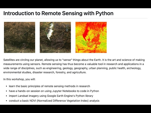
Instructor: Yoh Kawano Workshop materials: https://github.com/yohman/workshop-remote-sensing Satellites are circling our ...

1:04:39
Introduction to Remote Sensing with Python

20,148 views

3 years ago

Matt Forrest
5 Python Libraries Every GIS Pro Needs to Know!

... you a GIS data science expert and greatly improve your geospatial skillset, allowing you to perform complex spatial analysis.

1:15
5 Python Libraries Every GIS Pro Needs to Know!

5,132 views

6 months ago

PyCon 2018
Christy Heaton - Intro to Spatial Analysis and Maps with Python - PyCon 2018

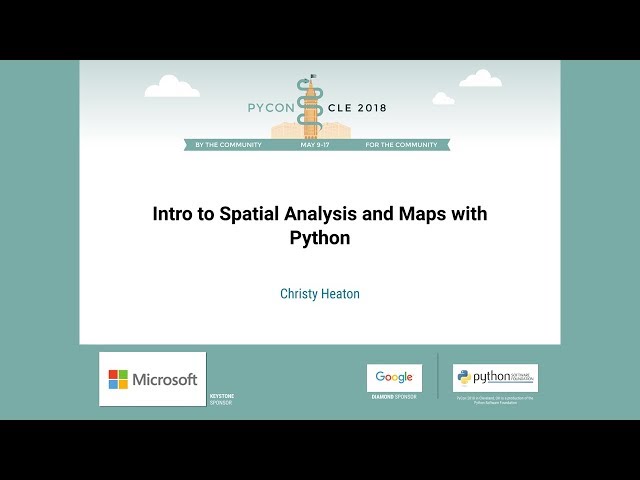
Speaker: Christy Heaton In this tutorial, we will introduce Python as a spatial problem solving and data visualization tool.

2:44:43
Christy Heaton - Intro to Spatial Analysis and Maps with Python - PyCon 2018

4,359 views

7 years ago

Matt Forrest
What Is Spatial Data? A Beginner’s Guide

Ready to move beyond desktop GIS? Step into the Spatial Lab: a global community for ambitious geospatial professionals who ...

8:28
What Is Spatial Data? A Beginner’s Guide

12,516 views

10 months ago

Matt Forrest
GIS and Python: Top Courses to Learn Geospatial Python

Ready to move beyond desktop GIS? Step into the Spatial Lab: a global community for ambitious geospatial professionals who ...

10:25
GIS and Python: Top Courses to Learn Geospatial Python

38,195 views

3 years ago

Matt Forrest
Analyze floods using ONLY Python! (aka spatial data science)

Ready to move beyond desktop GIS? Step into the Spatial Lab: a global community for ambitious geospatial professionals who ...

24:07
Analyze floods using ONLY Python! (aka spatial data science)

25,195 views

2 years ago

Matt Forrest
Spatial Data Explained: Raster vs. Vector

Whar are the differences between vector data, including points, lines, and polygons, and raster data? #SpatialData #VectorData ...

1:51
Spatial Data Explained: Raster vs. Vector

3,401 views

6 months ago

Deep Charts
How to use H3 Hexagon Grids for Spatial Analysis and Mapping in Python

This overview and tutorial describes how to begin using the H3 spatial indexing system for geospatial analysis and spatial data ...

4:19
How to use H3 Hexagon Grids for Spatial Analysis and Mapping in Python

9,494 views

1 year ago

Oracle Developers
Spatial for Python developers

This session focuses on using Python with spatial data stored in the Oracle Database. You will see live several examples of using ...

50:32
Spatial for Python developers

633 views

2 years ago

GIS Festival Conference
Pygeo: A Beginners Guide to Spatial Analysis with Python

Python is a high-level, open-sourced and general-purpose programming language and it is the most popular language used in ...

54:31
Pygeo: A Beginners Guide to Spatial Analysis with Python

247 views

2 years ago

maptimeDavis
Geospatial Raster & Vector Data with Python

Participants will learn how to open, work with, and plot vector and raster-format spatial data in Python, as well as how to access ...

1:31:49
Geospatial Raster & Vector Data with Python

719 views

3 years ago

Spatial Thoughts
Welcome to Python Foundation for Spatial Analysis Course

This video is part of our Python Foundation for Spatial Analysis course. Access the full course material and download the ...

1:31
Welcome to Python Foundation for Spatial Analysis Course

16,249 views

1 year ago