ViewTube

ViewTube
Sign inSign upSubscriptions
Filters

Upload date

Type

Duration

Sort by

Features

Reset

1,011 results

MAPOG
How to Create Land Parcel Polygon Maps | GIS & Spatial Analysis #GIS #UrbanPlanning #MappingTools

Want to accurately delineate land parcels for urban planning, real estate, or property assessment? In this tutorial, we'll show you ...

2:00
How to Create Land Parcel Polygon Maps | GIS & Spatial Analysis #GIS #UrbanPlanning #MappingTools

406 views

11 months ago

Prabhanshu
GeoPandas: An Introduction to Spatial Data Analysis in Python

Team- C010 Group Members- Ayushi Meena (24110063) Prabhanshu Chouhan (24110263) Saksham Chourasia (24110312) ...

3:53
GeoPandas: An Introduction to Spatial Data Analysis in Python

93 views

11 months ago

The Slop Farm
How to Use Python Console in Qgis - Full Guide

How to Use Python Console in Qgis - Full Guide | Surfshark VPN Deal — Stay private and secure. $1.99/mo + 3 Months Free ...

1:52
How to Use Python Console in Qgis - Full Guide

3 views

1 month ago

Dr. Ankush Rai
Excel 2 GIS Maps: Demo | Convert Excel Data to Interactive Satellite Maps with Python

... spatial data without GIS expertise. Try our solution today to transform your Excel location data into professional interactive maps ...

2:03
Excel 2 GIS Maps: Demo | Convert Excel Data to Interactive Satellite Maps with Python

54 views

9 months ago

GeoCortex AI and Consulting
Intro to PyQGIS – Automating Tasks with Python

Tired of repeating the same GIS steps in QGIS? In this video, you'll learn how PyQGIS lets you automate spatial workflows using ...

3:27
Intro to PyQGIS – Automating Tasks with Python

58 views

1 month ago

vlogize
Visualizing .geojson Coordinates Using Python

Unlock the potential of your `.geojson` files by easily plotting coordinates with this comprehensive Python guide using ...

1:50
Visualizing .geojson Coordinates Using Python

11 views

10 months ago

SPATIAL WINGS
Show Map Using Python | Load GeoJSON & Add Satellite Basemap | Web GIS Tutorial || Spatial Wings

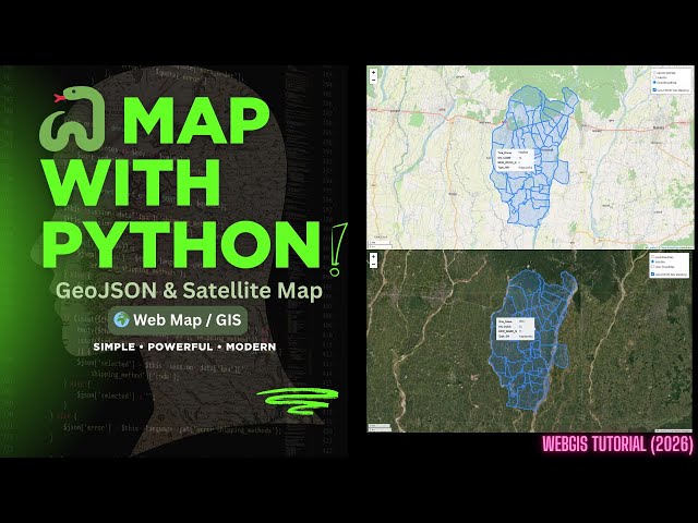
Show Map Using Python | Load GeoJSON & Add Satellite Basemap | Web GIS Tutorial || Spatial Wings #PythonGIS #GeoJSON ...

2:25
Show Map Using Python | Load GeoJSON & Add Satellite Basemap | Web GIS Tutorial || Spatial Wings

29 views

1 month ago

Arid agricultural Geospatial data science
Google Earth engine/Google colab/python/python library For GIS full course end to end 🔚new 2025

Google Earth engine/Google colab/python/python library For GIS full course end to end new 2025#GoogleEarthEngine ...

3:13
Google Earth engine/Google colab/python/python library For GIS full course end to end 🔚new 2025

48 views

9 months ago

ProgrammingKnowledge2
Install GeoPandas for Python in VS Code | Simplify Geospatial Data Analysis | Installation Guide

Working with geospatial data? 🗺️ GeoPandas is a powerful Python library that extends Pandas to handle geospatial data ...

2:01
Install GeoPandas for Python in VS Code | Simplify Geospatial Data Analysis | Installation Guide

780 views

10 months ago

GEO 2004
Geospatial Buffer Analysis in Miles or Any Other Unit

How to perform Buffer Analysis in Map Unit other than meters or degrees, no matter the projection system or coordinate system ...

2:48
Geospatial Buffer Analysis in Miles or Any Other Unit

66 views

11 months ago

vlogize
Enhancing Performance in Geographic Data Analysis with Dask and GeoPandas

This is particularly common in applications involving spatial analysis, mapping, and environmental studies. In this guide, we'll go ...

2:14
Enhancing Performance in Geographic Data Analysis with Dask and GeoPandas

2 views

10 months ago

vlogize
How to Explode a GeoPandas DataFrame by Rows with Geometry

Discover how to explode a `GeoPandas` DataFrame by rows, leveraging geometry data for better data handling and visualization ...

1:51
How to Explode a GeoPandas DataFrame by Rows with Geometry

3 views

10 months ago

AbhiNaksha GIS Academy
Udemy Course on "ArcGIS Pro with Python Automation"

https://www.udemy.com/course/arcgis-pro_python-arcpy/?couponCode=ONLY479.

2:32
Udemy Course on "ArcGIS Pro with Python Automation"

61 views

3 months ago

Rahul Ramteke
Google Earth Engine Python Interface: Accessing and Analyzing Geospatial Data

Exposition Assignment: Group:- C004 Group Members: Abhishek Tagalpallewar- 24110364 Madhura Melgiri- 24110203 Rahul ...

3:54
Google Earth Engine Python Interface: Accessing and Analyzing Geospatial Data

56 views

11 months ago

CodeRide
introduction to spatial data analysis

Get Free GPT4.1 from https://codegive.com/bef5cbd Okay, let's dive into a comprehensive introduction to spatial data analysis.

1:19
introduction to spatial data analysis

0 views

7 months ago

MapSyntax
Welcome to MapSyntax | Learn GIS & Python for Geospatial Data Science

GIS and programming don't have to feel overwhelming. In this first video, I share why I created MapSyntax — a channel built to ...

1:49
Welcome to MapSyntax | Learn GIS & Python for Geospatial Data Science

79 views

4 months ago

Chloropy
VITA for agricultural statistics

Access it here: https://vita.chloropy.com Introducing Vita, the powerful web application designed to make complex statistical ...

0:34
VITA for agricultural statistics

26 views

4 months ago

Spatial Lens
Remote Sensing vs GIS: What's the Difference?

Remote Sensing and GIS Explained Remote sensing and GIS tutorial for beginners! Learn how satellites capture Earth data and ...

1:06
Remote Sensing vs GIS: What's the Difference?

34 views

7 months ago

vlogize
How to Compare Elevation Values in Python Lists for Spatial Analysis

A comprehensive guide on how to compare a list of elevation values with another list of elements, highlighting the lower elevation ...

1:46
How to Compare Elevation Values in Python Lists for Spatial Analysis

0 views

5 months ago

Native GIS
GIS Careers Explained: Spatial Analyst, Modeler, or Engineer?

Unlock the world of GIS careers! In this video, we break down the real differences between a Spatial Analyst, a GIS Modeler, and a ...

2:57
GIS Careers Explained: Spatial Analyst, Modeler, or Engineer?

536 views

7 months ago