Upload date
All time
Last hour
Today
This week
This month
This year
Type
All
Video
Channel
Playlist
Movie
Duration
Short (< 4 minutes)
Medium (4-20 minutes)
Long (> 20 minutes)
Sort by
Relevance
Rating
View count
Features
HD
Subtitles/CC
Creative Commons
3D
Live
4K
360°
VR180
HDR
9,172 results
Visually explained the difference between iterators and iterables in Python using enumerate, map, and filter with simple examples.
17,358 views
9 months ago
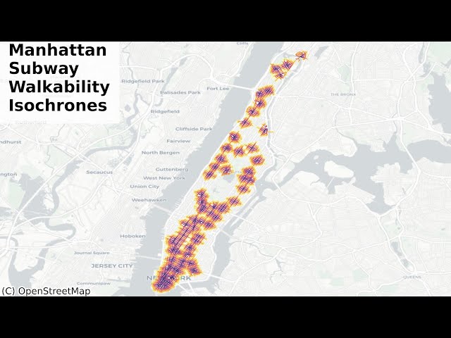
In this video, I am going to show you Pythonic methods to visualize how walkable New York City - Manhattan, is from each subway ...
849 views
8 months ago
The math behind Google Maps. Sponsored by boot.dev - Click this link https://boot.dev/?promo=VERITASIUM and use our code ...
7,631,509 views
1 month ago
To learn for free on Brilliant, go to https://brilliant.org/techwithtim . Brilliant's also given our viewers 20% off an annual Premium ...
39,818 views
5 months ago
Find the shortest route through real city streets using Python! For both driving and walking! In this tutorial, we use OSMnx, ...
6,979 views
11 months ago
Dive into the world of GIS and mapping with this Python tutorial! We'll turn OpenStreetMap data into a mesmerizing animater ...
1,103 views
Learn how to access and visualise global elevation and ocean depth data (ETOPO) in Python* — with 2D maps in matplotlib and ...
927 views
10 months ago
Subscribe and Support the channel for more Free content https://www.youtube.com/ @DataWithBaraa ━━━━━ *MY ...
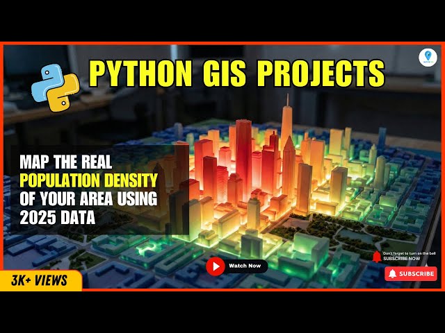
37,183 views
How do you actually map population density at scale? In this video, I break down the complete GIS workflow for creating a ...
2,155 views
7 months ago
In this video, you will learn Lambda functions, Map, and Filter in Python from scratch in a simple and beginner-friendly way.
14 views
Access the colab notebook affiliated with this video here: ...
36 views
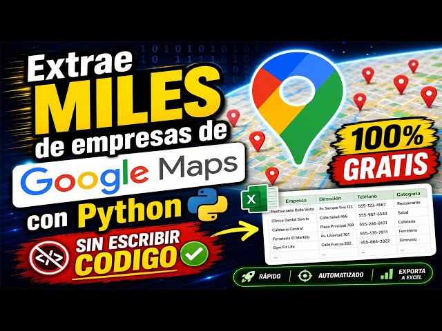
En este tutorial paso a paso, aprenderás a crear un Scraper de Google Maps con Python para extraer información valiosa de ...
44 views
Recorded Feb 4, 2021 Interviewer: Evan Hackett Interviewee: Keegan Good Evan challenges me to create the map function from ...
0 views
python map function | python lecture 19 | map function python | map function in python | python map | python lambda | lambda ...
16 views
2 weeks ago
Get 3D GeoAI System → https://learngeodata.eu/geo-ai-sprint-course Get my Book → https://amzn.to/49d1rW2 ...
3,998 views
This video shows how to draw a simple Point Map in Python.
28 views
3 months ago
This video is designed to walk you through how to create a simple 2d tile map using Python and Tkinter. In this course, you'll: ...
228 views
6 months ago
The Black Ops 1 Shangri-La Pack a Punch Challenge. The 31 Guns: m1911 m14 olympia pm63 mpl mp5k ak74u m16 stakeout ...
46,023 views
17 hours ago
Learn how to build a full-stack Python web app using Shiny for Python and ipyleaflet. In this step-by-step tutorial, you'll create an ...
40 views
2 months ago
A full guide to Novation Launchpads: beginner-friendly, affordable, and insanely customizable. See how they compare to Push ...
89,703 views