Upload date
All time
Last hour
Today
This week
This month
This year
Type
All
Video
Channel
Playlist
Movie
Duration
Short (< 4 minutes)
Medium (4-20 minutes)
Long (> 20 minutes)
Sort by
Relevance
Rating
View count
Features
HD
Subtitles/CC
Creative Commons
3D
Live
4K
360°
VR180
HDR
176,078 results
Learn GeoPandas and Modern GIS by joining the Spatial Lab ➡️ https://forrest.nyc/spatial-lab/ ⬅️ Looking to dive into ...
74,224 views
1 year ago
Workshop materials available here: https://github.com/yohman/workshop-python-spatial-stats Visual interpretations are ...
17,362 views
4 years ago
Ready to move beyond desktop GIS? Step into the Spatial Lab: a global community for ambitious geospatial professionals who ...
13,754 views
14,351 views
11 months ago
... View - 01:22:04 Spatial Analysis: Ball Territory - 01:26:34 Implementation Challenges - 01:28:29 Beyond the Basics: What Else ...
317,446 views
Welcome to METEOROLOGY-RELATED Pep Talk. This video focuses on generating spatial diagrams from multi-dimensional ...
6,046 views
5 years ago
Learn more: https://spatialelearning.com Get the full course: ...
11,349 views
3 years ago
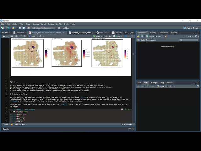
Learn how to estimate a geospatial risk predictive model in R. Using open data from San Francisco, we learn new tools for helping ...
5,012 views
TRANSFORM 2020 - Virtual Conference Speaker: Martin Bentley To access the repos link: https://swu.ng/t20-fri-geo Dedicated ...
3,710 views
Streamed 5 years ago
... don't know um so I've shown you geopanners which is really sort of the basis of doing geospatial data analysis in Python and to ...
19,718 views
Streamed 8 years ago
In this webinar, you will learn how to carry out Spatial weights, spatial lag and Spatial auto-correlation: in hotspot analysis in ...
2,743 views
GeoPandas is the geospatial implementation of the big data oriented Python package called Pandas. GeoPandas enables the ...
22,447 views
Streamed 7 years ago
... techniques are practiced and then we'll review some tools which we can use with python to process authorization data and then ...
10,933 views
Whether your analysis requires a powerful spatial data science workstation or a dynamic scripting environment hosted on a ...
9,175 views
Introduction to Spatial Data Analysis with Python #Map-Projection and #CoordinateSystems in #ArcGIS A Complete QGIS Tutorial ...
3,689 views
We introduce the python shapely library for manipulating polygons.
1,211 views
Speakers in this part of the workshop: Fabian Theis & Giovanni Palla (Helmholtz Munich, Germany) The workshop was held by ...
8,337 views
25,766 views
2 years ago
by Jenny Palomino Attendees will learn about geoprocessing, analyzing and visualizing spatial data using Python and how it ...
20,384 views
10 years ago
This tutorial is an introduction to geospatial data analysis in Python, with a focus on the Python Spatial Analysis Library (PySAL).
12,732 views
This video details using DeepSeek, Python, & ArcGIS Pro to boost productivity within ArcGIS Pro. Specifically, we will be scripting ...
566 views
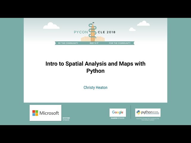
Speaker: Christy Heaton In this tutorial, we will introduce Python as a spatial problem solving and data visualization tool.
4,360 views
7 years ago
Sign up for our free webinar series and see what's coming up next! https://cambridgespark.com/webinar About this webinar: The ...
2,642 views
TRANSFORM 2020 - Virtual Conference Michael Pyrcz To access the repos link: 0:28 Start of stream and intro 6:16 Intro to ...
250 views