Upload date
All time
Last hour
Today
This week
This month
This year
Type
All
Video
Channel
Playlist
Movie
Duration
Short (< 4 minutes)
Medium (4-20 minutes)
Long (> 20 minutes)
Sort by
Relevance
Rating
View count
Features
HD
Subtitles/CC
Creative Commons
3D
Live
4K
360°
VR180
HDR
112,120 results
Learn GeoPandas and Modern GIS by joining the Spatial Lab ➡️ https://forrest.nyc/spatial-lab/ ⬅️ Looking to dive into ...
74,283 views
1 year ago
We were super excited to have Dhaniel Carvalho joining us to cover Automation and Python Scripting in Resource Geology: ...
9,047 views
3 years ago
Being able to quickly visualize your data as you work, as well as publish your results for others to see, interact with, and ...
23,661 views
4 years ago
... don't know um so I've shown you geopanners which is really sort of the basis of doing geospatial data analysis in Python and to ...
19,718 views
Streamed 8 years ago
Dataset: https://github.com/iamtekson/geospatial-data-analysis-python/raw/master/data/geotiff/nepal_lc_2020.tif Full course: ...
30,182 views
Sherrie Xie, Post-doctoral research fellow at the University of Pennsylvania gave a workshop at the R/Medicine 2022 Virtual ...
13,616 views
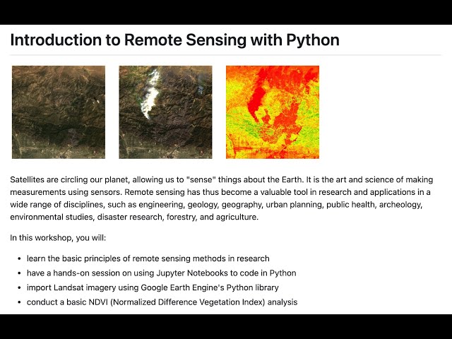
Instructor: Yoh Kawano Workshop materials: https://github.com/yohman/workshop-remote-sensing Satellites are circling our ...
20,425 views
This overview and tutorial describes how to begin using the H3 spatial indexing system for geospatial analysis and spatial data ...
10,151 views
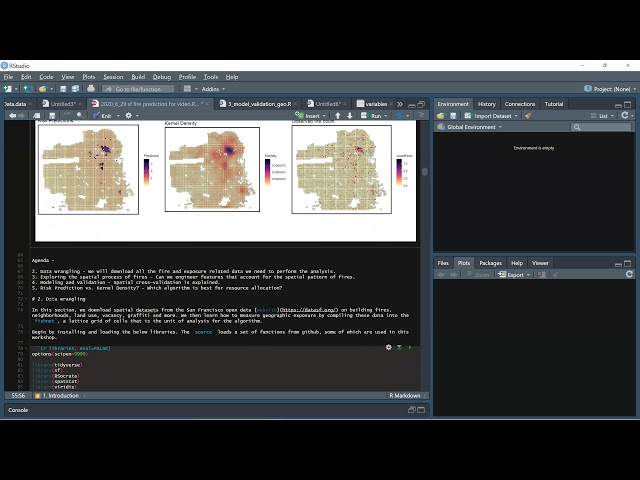
Learn how to estimate a geospatial risk predictive model in R. Using open data from San Francisco, we learn new tools for helping ...
5,013 views
This video is a part of the "Geospatial analysis with Python" available for free at ...
24,516 views
Streamed 4 years ago
It's a complete beginners tutorial to get started with Python Geospatial data analysis.
20,389 views
krishna lodha's talk at XtremePython 2021. You can find more information about this talk and about XtremePython online ...
998 views
This "Geospatial Analysis With Python" is a beginner's course for those who want to learn the use of python for gis and geospatial ...
42,758 views
Learn Python for geospatial data analysis using ArcGIS Pro Notebooks (built on Jupyter notebooks)—a practical, job-relevant ...
176 views
9 days ago
Ready to move beyond desktop GIS? Step into the Spatial Lab: a global community for ambitious geospatial professionals who ...
13,758 views
Learn more: https://spatialelearning.com Get the full course: ...
81,092 views
My invited talk on May 27, 2022. Slides: https://gishub.org/ussein Moderator: Dr. Labaly Toure at the University of Sine Saloum, ...
8,243 views
Download demo dataset: https://github.com/iamtekson/geospatial-data-analysis-python/tree/master/data/shp This video is the part ...
48,346 views
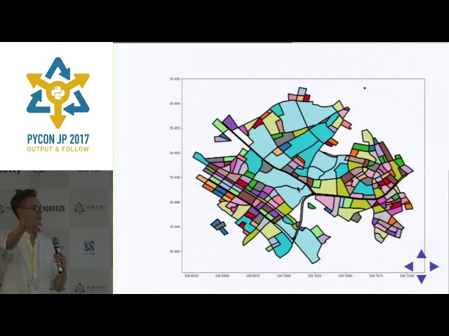
Workshop materials available here: https://github.com/yohman/workshop-python-spatial-stats Visual interpretations are ...
17,363 views